Integrated Sensing and Communication (ISAC)
Integrated Sensing and Communication (ISAC) is one of the flagship 6G capabilities that transforms mobile networks from communication systems into spatially aware platforms – merging high-speed communication and environmental sensing into a single unified infrastructure.
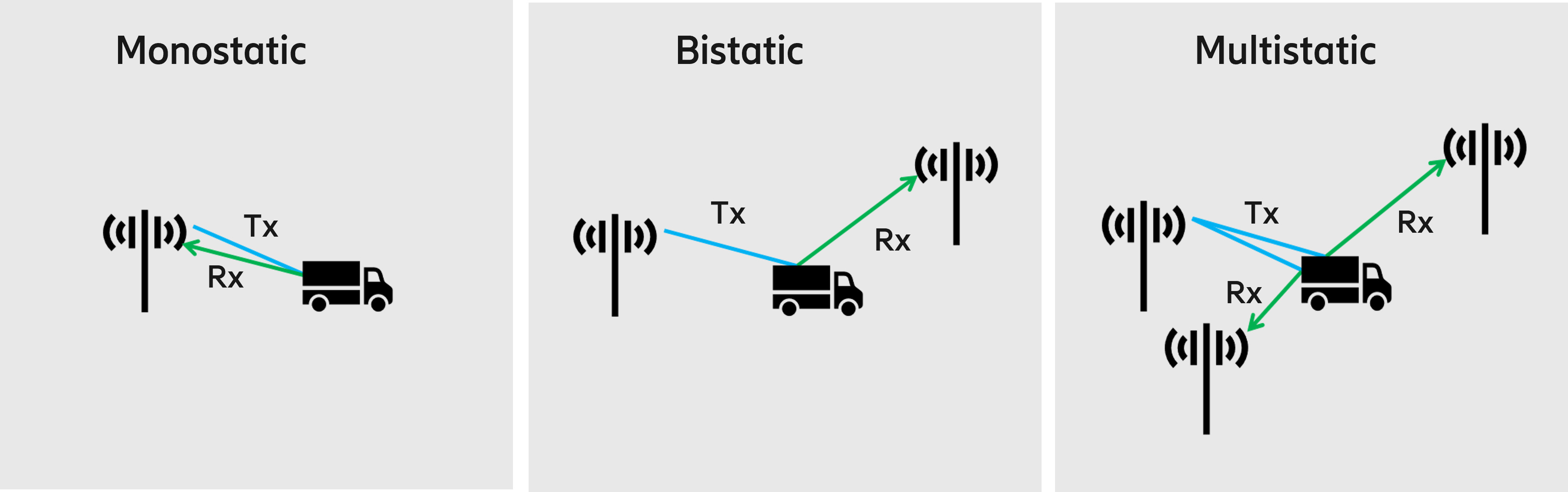
By leveraging mobile network infrastructure – towers, spectrum, antennas, and some hardware – ISAC can detect, locate, and track objects (including passive ones with no electronics). This will enable a wide range of use cases such as UAV airspace monitoring, autonomous vehicle safety, industrial automation, and immersive AR experiences. Commercial deployment is expected alongside 6G rollouts in the 2030 timeframe, with early implementations paving the way already in 5G.
As the industry moves from 5G Advanced toward 6G, ISAC is one of the features that will allow mobile networks to expand their role from connectivity enablers to critical infrastructure for safety, security, and economic growth.
What is Integrated Sensing and Communication (ISAC)?

Why ISAC matters: The strategic value proposition
Key use cases


The ISAC evolution
Core technologies enabling ISAC